Names of investigators
Associate Professor Ewan Cameron, Professor Peter Gething, Camilo Vargas, Professor Nick Golding, Mauricio van den Berg, Sarah Connor
Project description
Building on their experience in developing epidemiological tools to forecast seasonal malaria epidemics and the impact of antimalarial intervention campaigns, a group of researchers in The Kids Research Institute Australia’s Geospatial Health and Development team have developed a new model for simulating COVID-19 outbreaks in Western Australia - called GEO-COV.
By combining geographic datasets from the Australian Bureau of Statistics, The Western Australian Land Information Authority (Landgate), WA Department of Health, WA Department of Education, The Australian Curriculum, Assessment and Reporting Authority (ACARA), and Google Mobility trends, the researchers have created a spatialy-explicit computational representation of the State’s population.
Each model household is assigned a unique family composition with any children allocated to specific schools or daycare locations with respect to local catchment boundaries and any working adults assigned to workplaces according to proximity, industry of employment and mode of transport to work.
The realistic contact networks emerging from this model are then harnessed to a mechanistic simulator of covid transmission featuring real-world control measures, such as contact tracing and test-triggered isolation, to allow researchers to forecast the trajectory of new and ongoing outbreaks and predict the impact of possible changes to existing control measures.
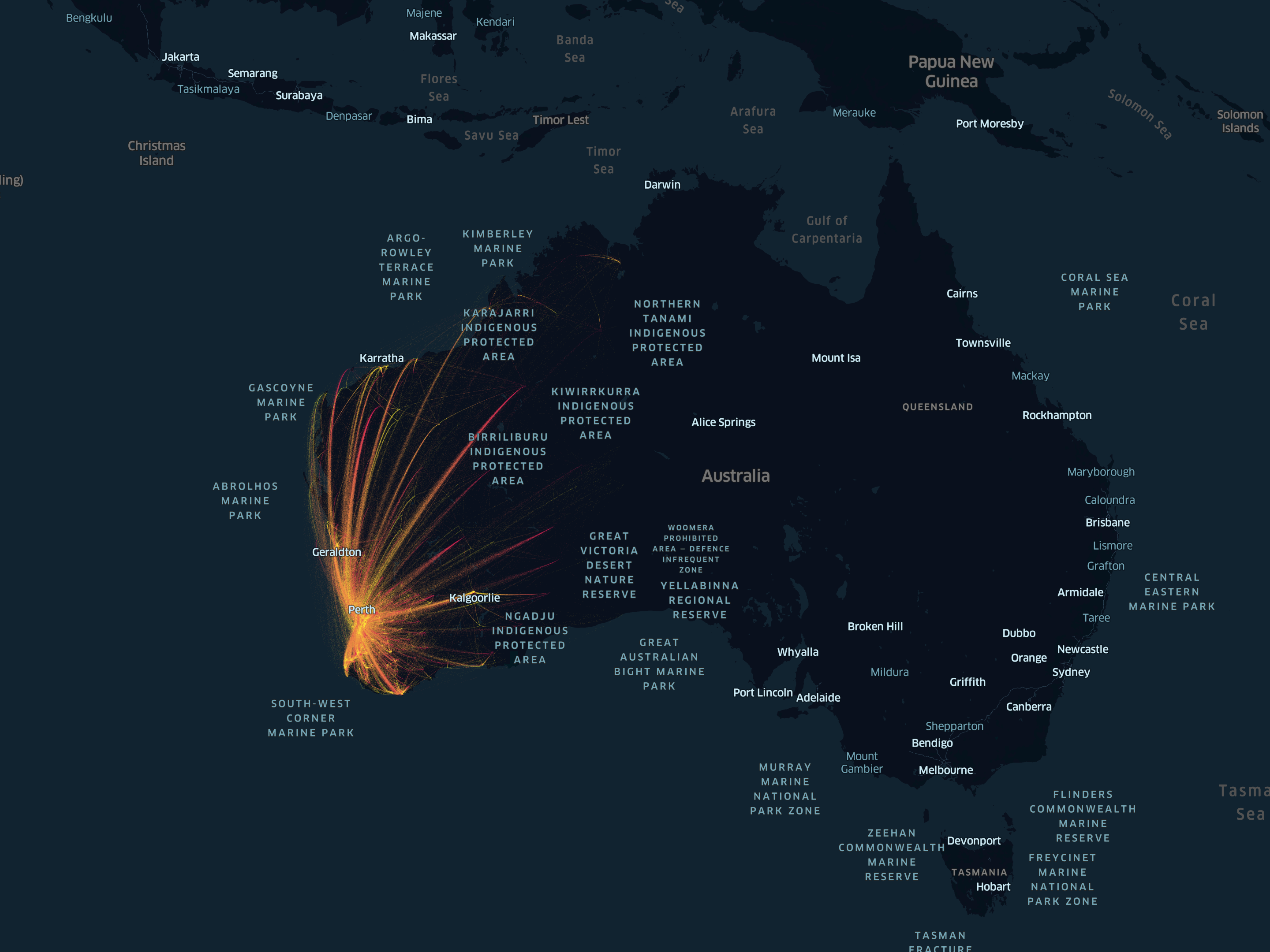
Modelling population movement. A fine-grained origin-destination simulation is incorporated into the COVID-19 modelling work. This graphic shows modelled flows of people traveling for work in Western Australia.
Summary
The researchers have created a sophisticated new software tool for studying covid-19 outbreaks in Western Australia that aims to capture the unique physical and social geography of life in the State. By harnessing “Big Data” from a variety of sources, including the Australia Bureau of Statistics and Google, the scientists have created a virtual simulation of Perth and its 2.7 million residents, each assigned to households, communities, schools and workplaces with locations matched one-to-one against the real world. When modelled COVID infections are introduced to this virtual world the spread of the epidemic follows a corresponding virtual social network, which we believe can capture the key features of the real interactions of our daily lives.
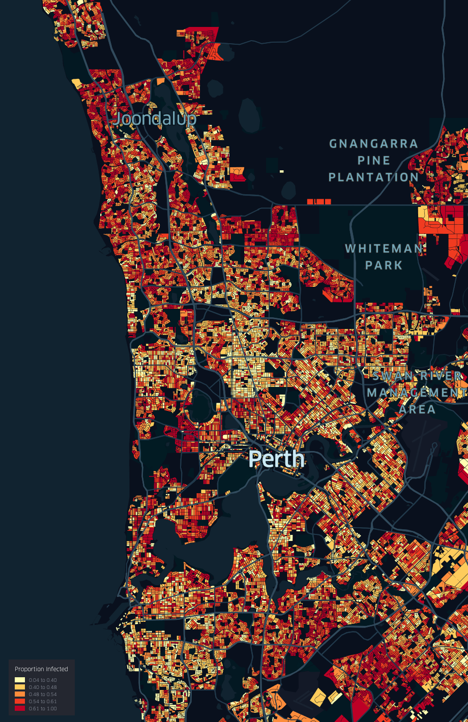
Modelling epidemic patterns. Fine-grained simulation outputs can be generated with the COVID-19 modelling work.
This graphic shows an example for the spatial pattern of the final Omicron outbreak size in one of the hundreds of realisations generated by the simulation software for the Perth Metropolitan Area.
These modelled patterns are compatible with non-spatial daily reported cases for Western Australia. This image was generated using Location Information from Landgate.